Photo Gallery
November 2020
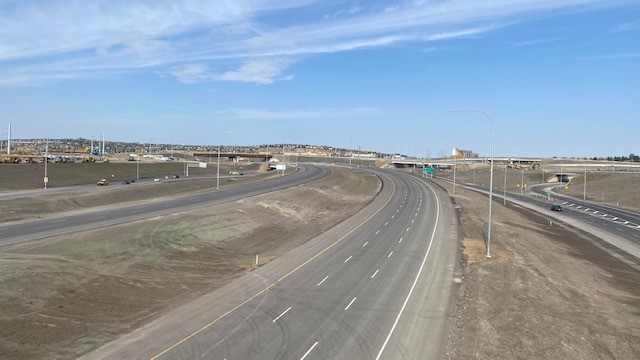
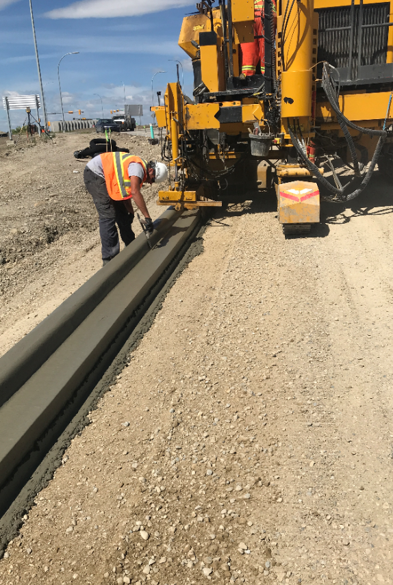
October 2020
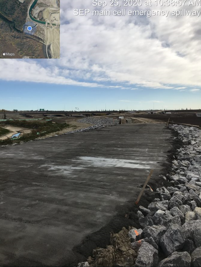
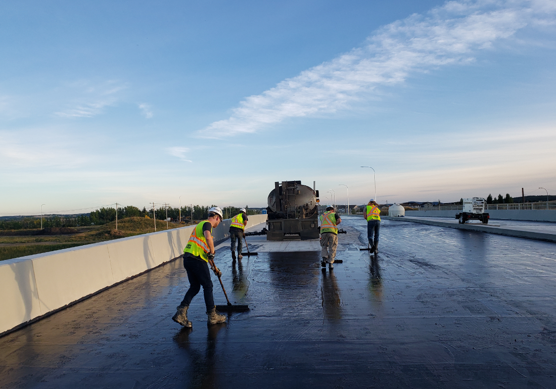
September 2020
August 2020
October 2019

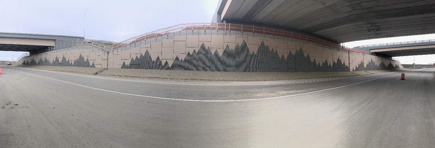
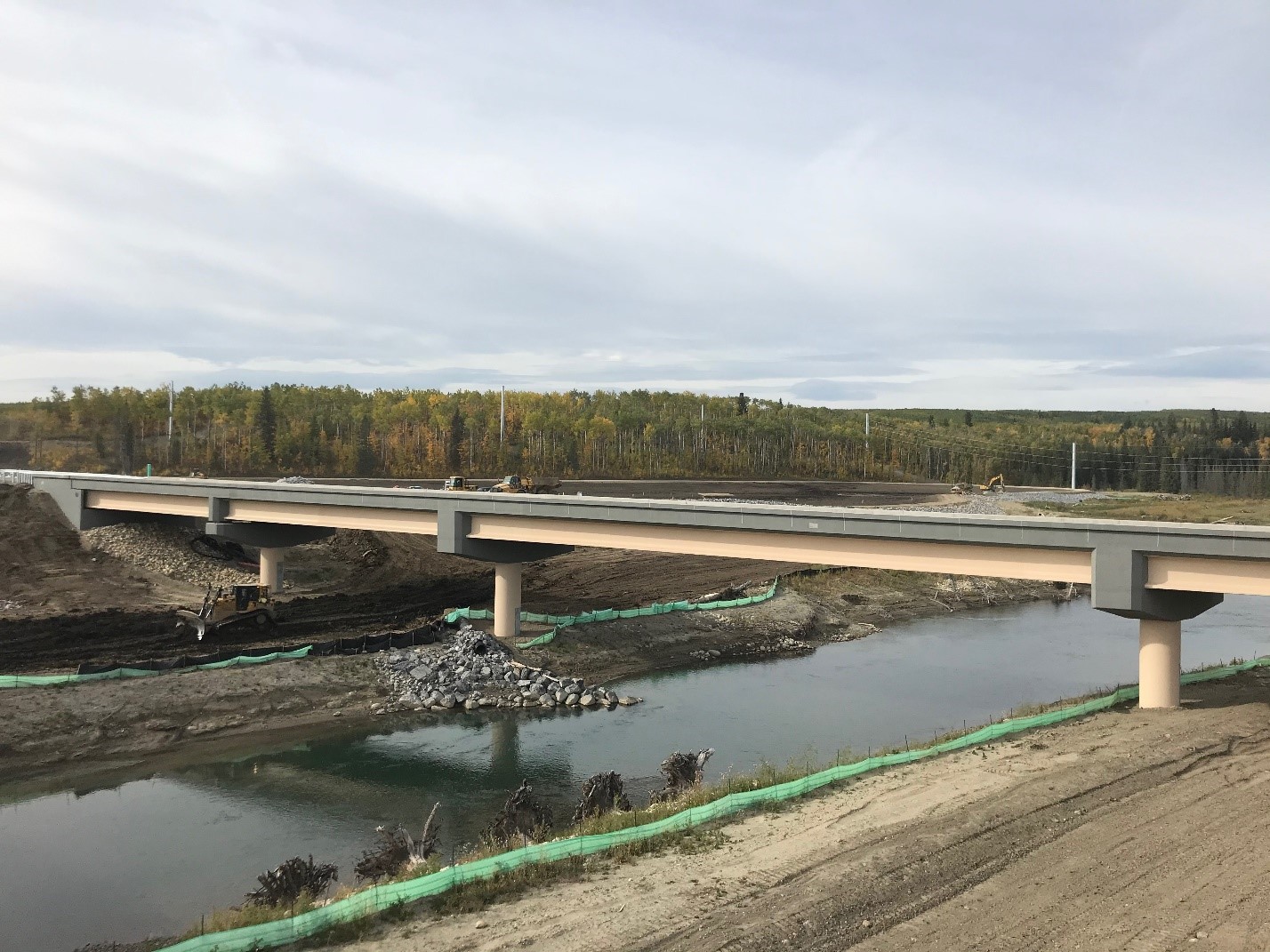
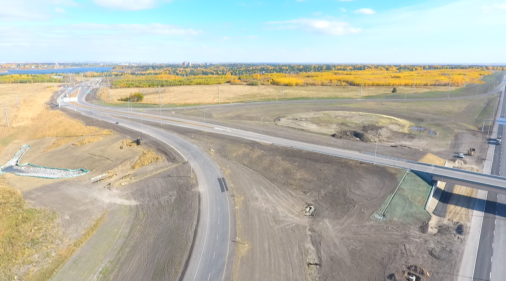
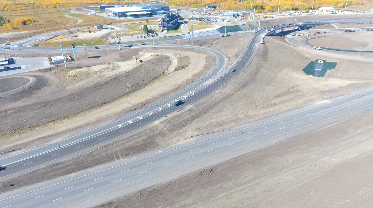
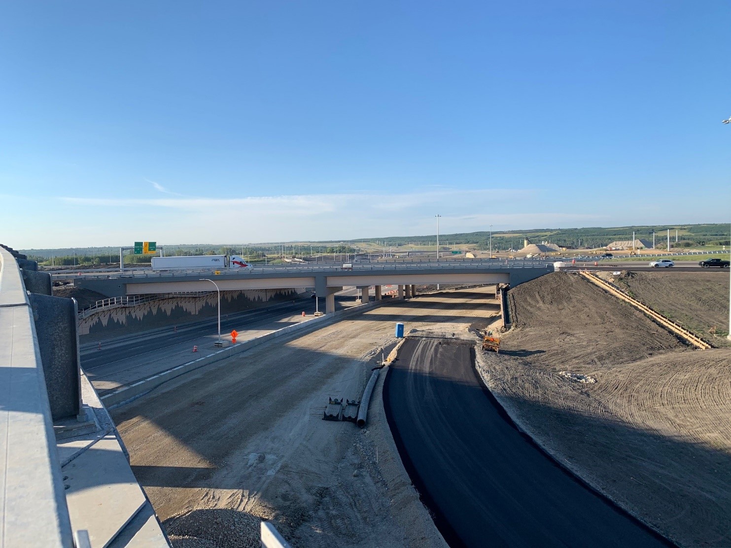
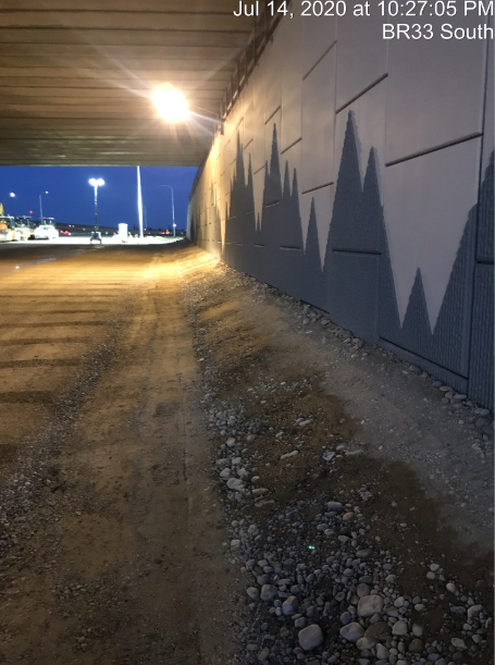
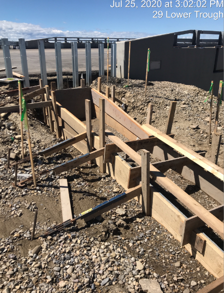
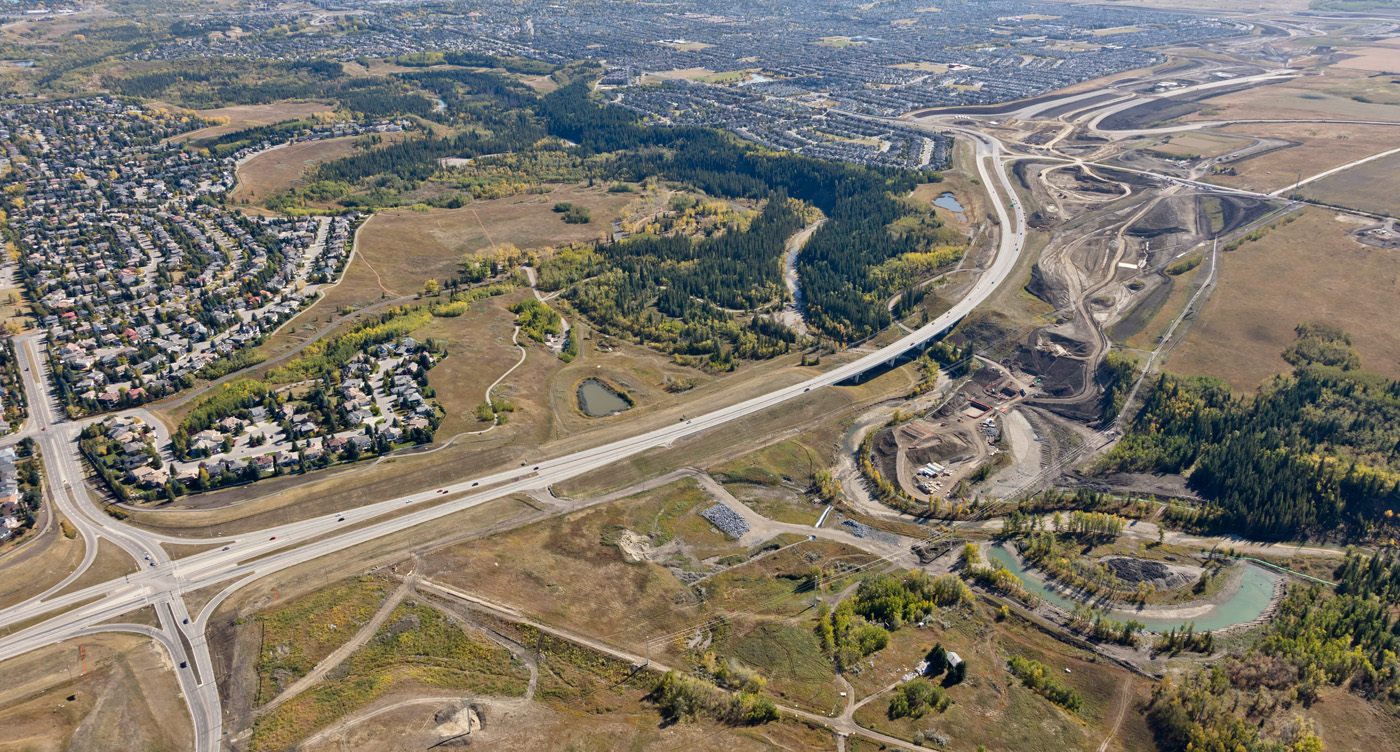
Weaselhead Road Tunnel under SWCRR

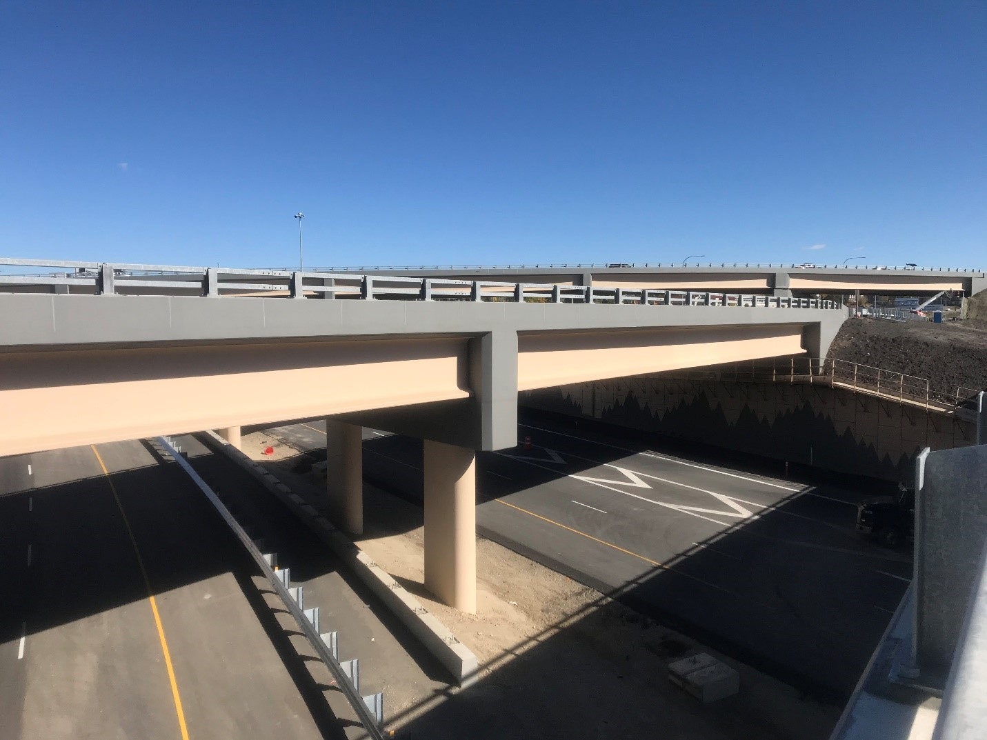
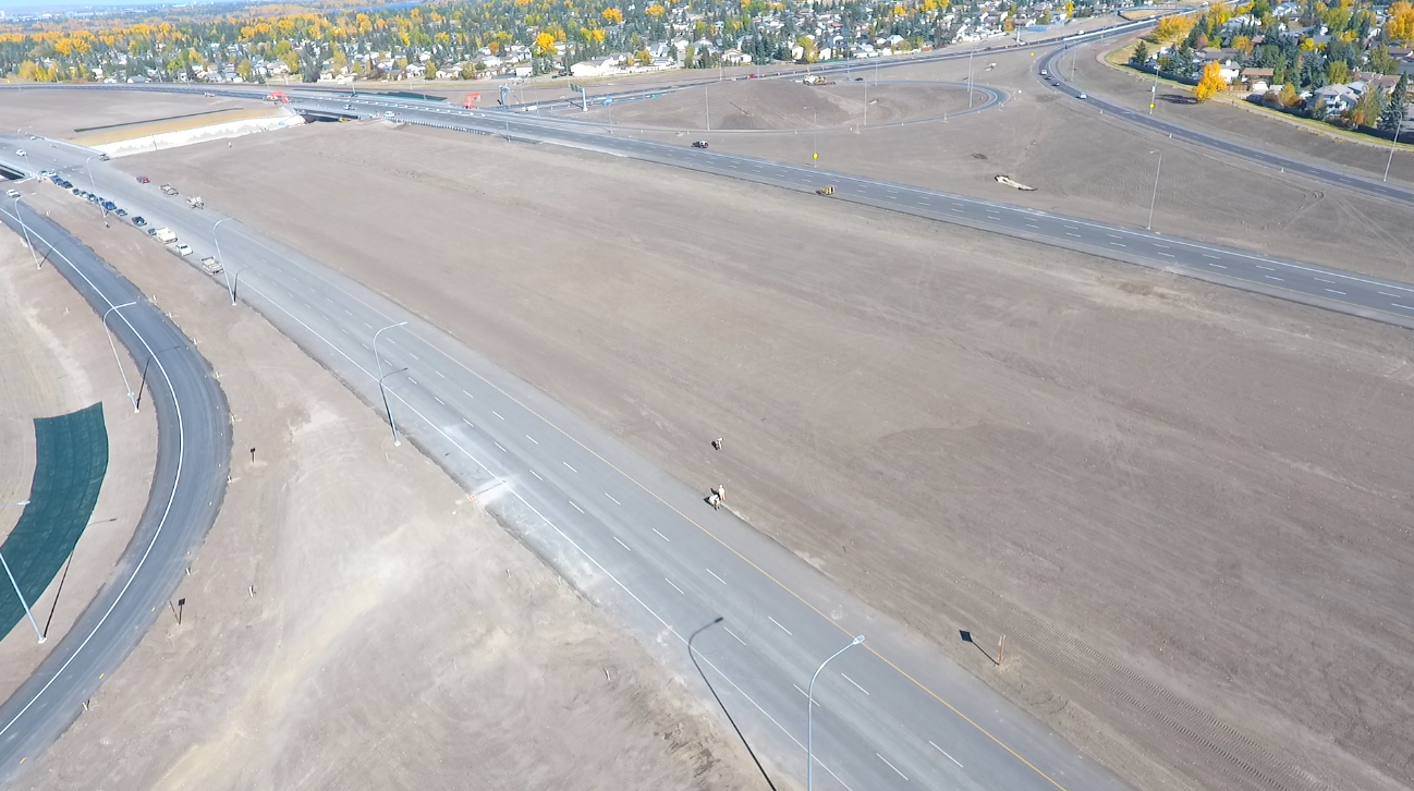
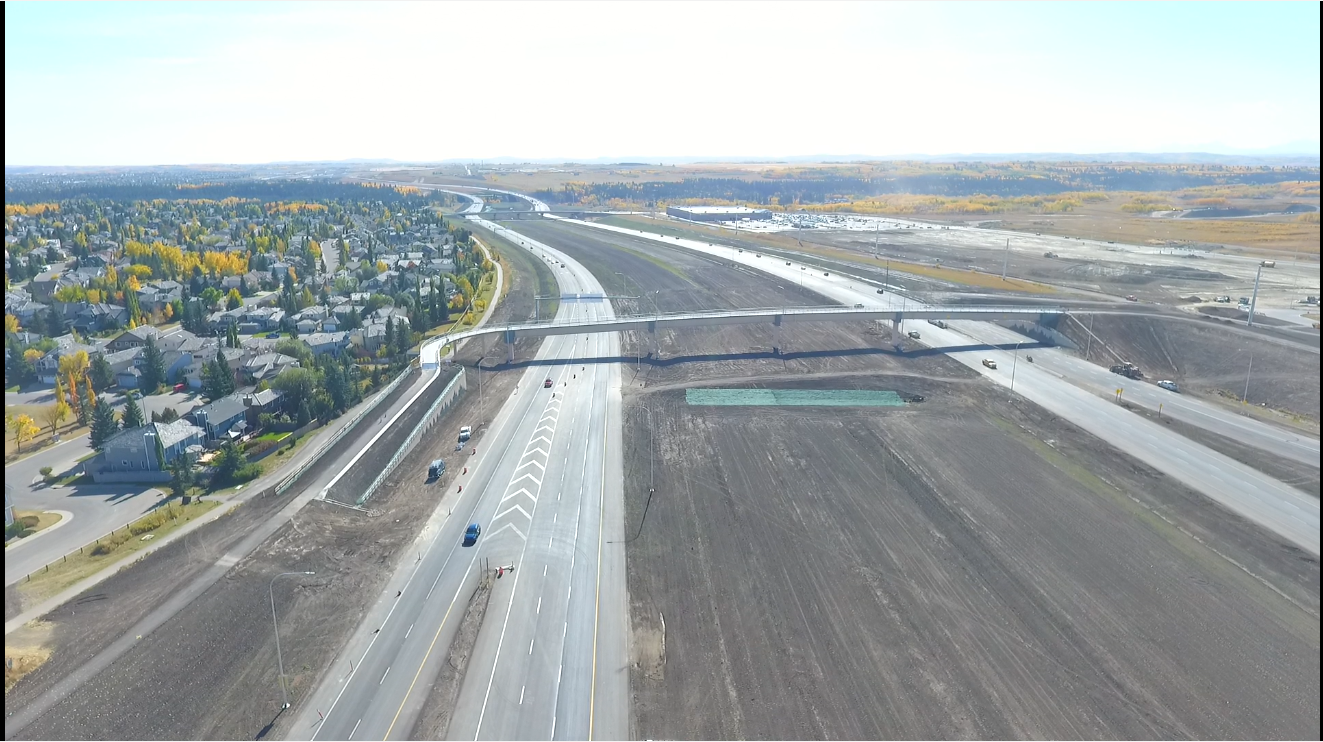
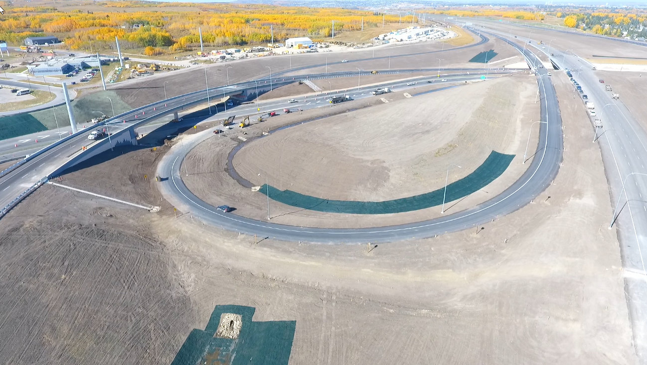
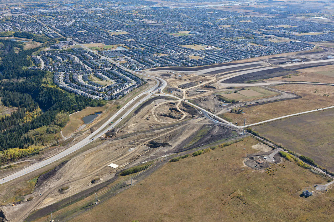
Sarcee-Glenmore Interchange to Westhills Way looking West

Sarcee-Glenmore Interchange looking West

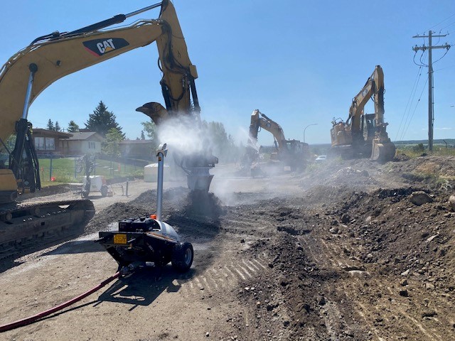
Sarcee-Glenmore Interchange looking South

Sarcee-Glenmore Interchange looking North

Sarcee-Glenmore Interchange looking North

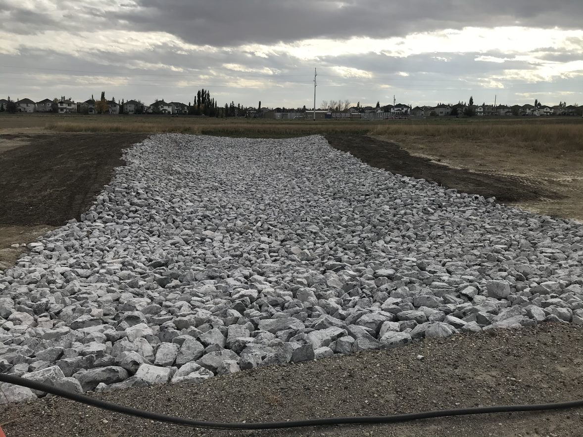
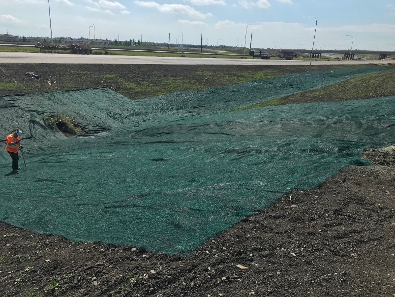
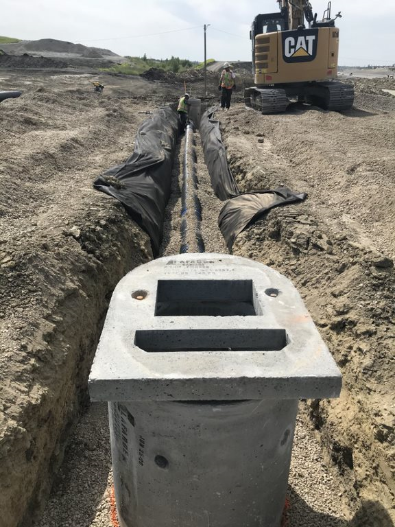
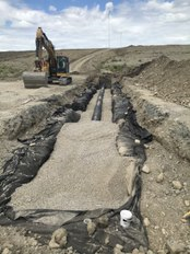
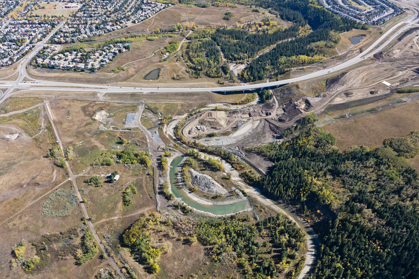
North Elbow Pond Rip Rap Spillway

Girder erection for future Anderson Road Interchange looking West

Girder erection for future Anderson Road Interchange looking South

Girder erection for future Anderson Road Interchange looking North

Girder erection for future Anderson Road Interchange

Girder erection for future Anderson Road Interchange

Girder erection for future Anderson Road Interchange

Girder erection for future Anderson Road Interchange

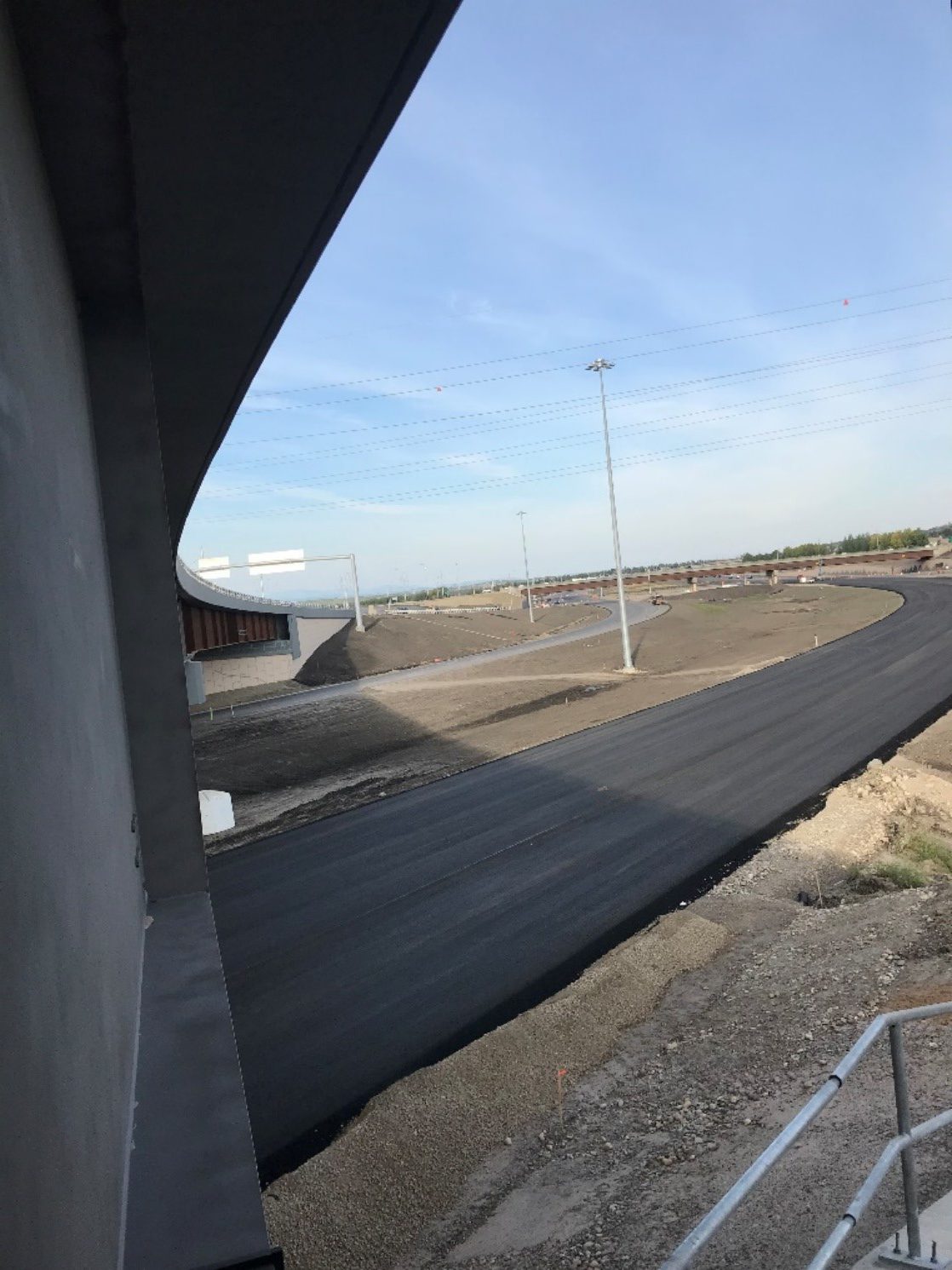
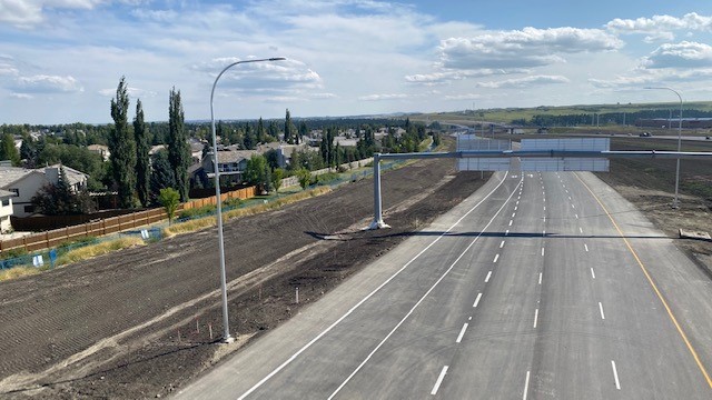
Future Westhills Way Overpass

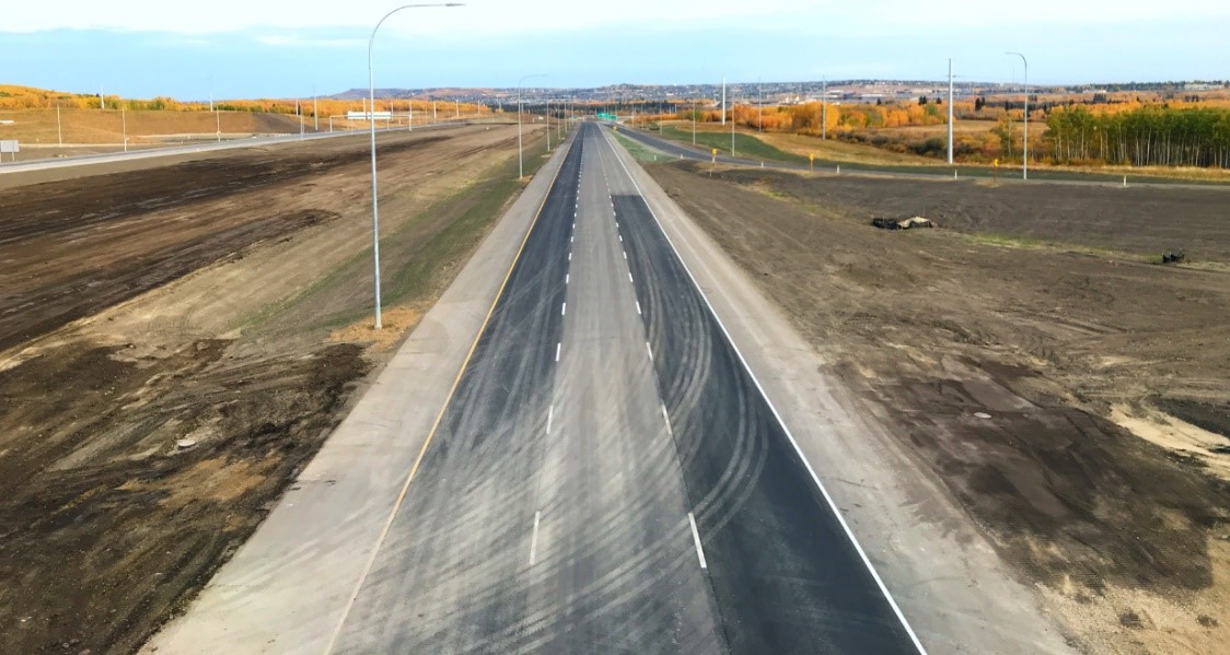
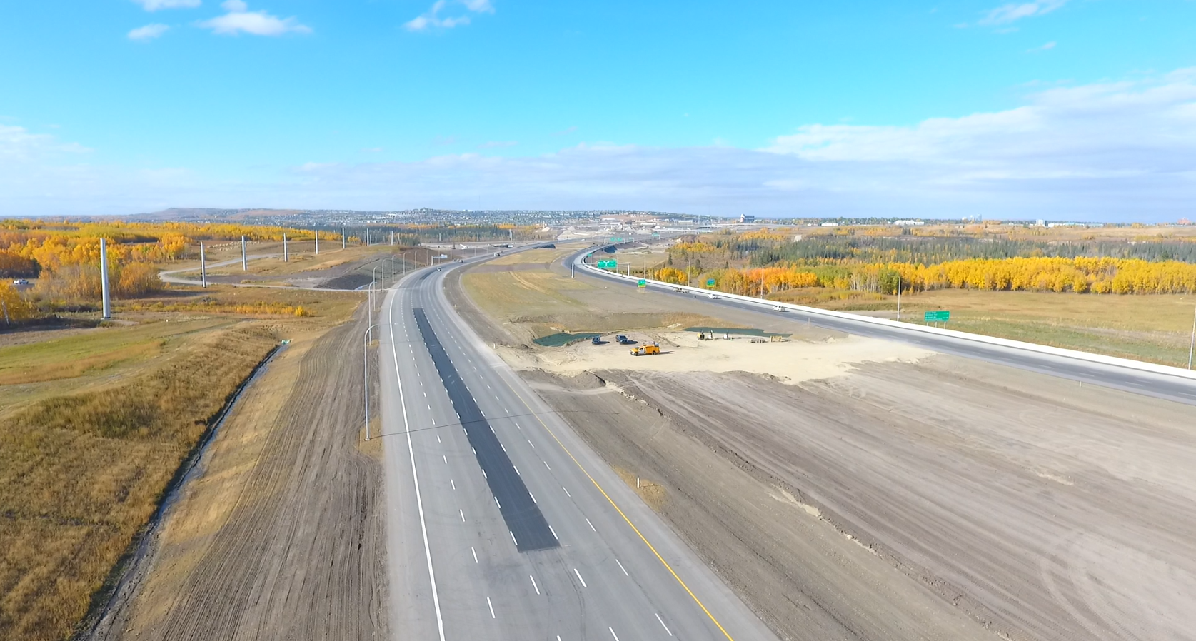
Future Southbound SWCRR through Elbow Valley

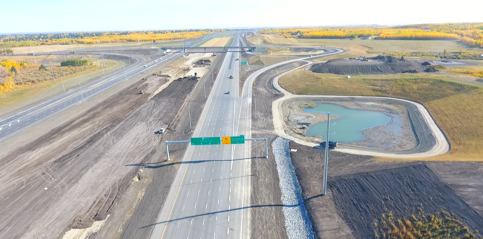
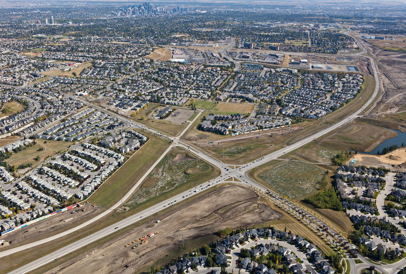
Future 162nd Ave Overpass

Future 162nd Ave Overpass looking North

Future 162nd Ave Overpass looking North

Future 162nd Ave Overpass looking North
April 2019
")
Bridges at various stages of completion at the Macleod Trail interchange (looking southwest)
")
Bridges under construction at Macleod Trail, with the Highway 22X corridor in the background (looking northwest)
")
Bridges under construction and earthworks at the Macleod Trail interchange (looking north)
")
The gap showing where the original Highway 22X bridge was removed, as well as the newly constructed bridge for the future westbound alignment (looking northeast)
")
Eastbound and westbound traffic realigned onto the future westbound SWCRR at Macleod Trail, with the old portion of Highway 22X being milled out (looking southeast)
")
The Highway 22X project corridor from Macleod Trail to 69 Street (looking west)
")
New ramp realignments and bridge construction at the intersection of Highway 22X and 6 Street / Sheriff King Street (looking southeast)
")
Bridge construction adjacent to the intersection of Highway 22X and James McKevitt Road / Spruce Meadows Way, with nearby stormwater ponds and Spruce Meadows (looking southeast)
")
Earthworks underway to build new road in the median of Highway 22X in preparation for a significant traffic realignment later this year (looking southwest)
")
The western extent of the Highway 22X corridor with earthworks in the foreground, as well as new road alignment in the median of Highway 22X and to the north (looking northwest)
")
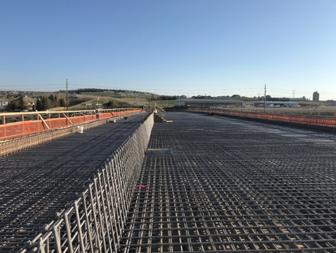
New bridge at 37 Street and Fish Creek Boulevard ready for night shift deck pours (looking northwest)
")
New bridge taking shape at Fish Creek, with the river realignment and bioengineering shown in the background (looking west)
")
New bridge at 37 Street and 130 Avenue / Buffalo Run Boulevard (looking northwest)
")
Earthworks and bridge construction for the Anderson Road interchange (looking northwest)
")
Three bridges and retaining walls under construction in the Anderson Road interchange (looking northwest)
")
The Anderson Road interchange taking shape (looking west)
")
View showing the scale of the Anderson Road interchange and the Tsuut'ina Nation's 7 Chiefs Sportsplex (looking southeast)
")
Construction by the City of Calgary to build the connections at 90 Avenue and Southland Drive (looking northwest)
")
The intersection of Southland Drive and 90 Avenue is largely complete, with asphalt, curbs and drainage in place (looking southwest)
")
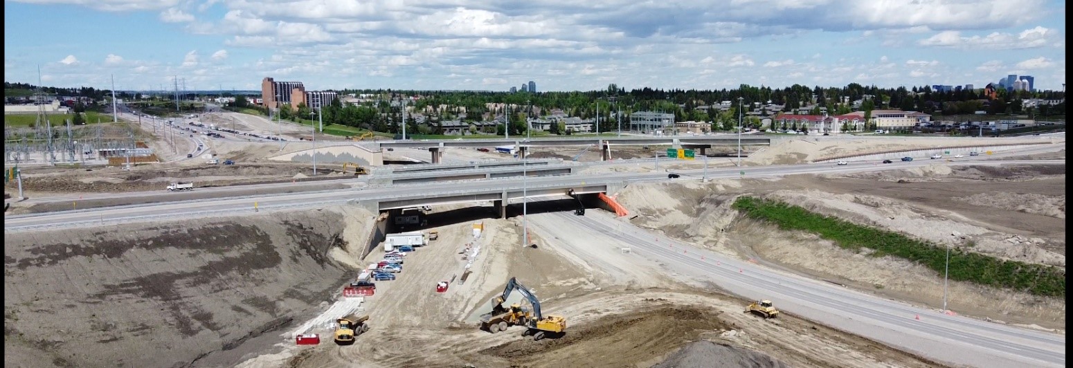
Work continues on the three bridges, tunnel and stormwater ponds in the Elbow River Valley (looking northwest)
")
View of the scale of the Sarcee Trail interchange, with 11 bridges under construction (looking northwest)
")
Construction activities along Glenmore Trail and Highway 8 (looking west)
")
The intersection at Glenmore Trail and 37 Street, with Grey Eagle Boulevard and the Grey Eagle Resort and Casino in the background (looking southwest)
")
Foundation construction underway for the new bridge at Glenmore Trail and 37 Street (looking south)
")
Placing girders on three bridges in the Sarcee Trail interchange (looking south)
")
Another view of the activity for the Sarcee Trail interchange, as well as earthworks along Glenmore Trail (looking northeast)
")
The alignment of the new bridge at Highway 8 and 69 Street (looking northeast)
")
Earthworks near Highway 8 and 69 Street (looking southeast)
")
The future eastbound alignment taking shape along Highway 8 in preparation for a significant traffic realignment later this year (looking southwest)
")
Trucks placing embankment for the approach to the new bridge on Highway 8 crossing the Elbow River (looking southwest)
")
The new bridge at Highway 8 and the Elbow River being prepared for the deck pour (looking north)
")
The excavation and gravel stockpiles at the North Gravel Site (looking northwest)
January 2019
")
View of the interchange for Highway 22X and Macleod Trail (looking northeast)
")
Demolition of the old Highway 22X bridge spanning Macleod Trail and placing girders on the new bridge from eastbound Highway 22X to northbound Macleod Trail (looking northeast)
")
Comparison of the new and old Highway 22X bridges spanning Macleod Trail (looking north)
")
View of the interchange for Highway 22X and Macleod Trail, as well as the SWCRR project corridor to the west (looking northwest)
")
View of the interchange with eastbound and westbound traffic realigned onto the ultimate westbound lanes - allowing for the demolition and upgrade of the old portion of Highway 22X (looking southwest)
")
View from the Macleod Trail and Highway 22X interchange at the existing Stoney Trail corridor (looking east)
")
View of the bridges spanning the Canadian Pacific Railway line, as well as the intersection of Highway 22X and 6 Street / Sheriff King Street (looking northwest)
")
Comparison of the new SWCRR bridge and old Highway 22X bridge, both spanning the Canadian Pacific Railway line (looking northeast)
")
View of the SWCRR project corridor along Highway 22X (looking northwest)
")
Snow covering earthworks at the intersection of Highway 22X and James McKevitt Road / Spruce Meadows Way (looking southwest)
")
Earthworks for the interchange from eastbound / westbound Highway 22X to northbound SWCRR (looking southwest)
")
Piling and earthworks at the intersection of Highway 22X and James McKevitt / Spruce Meadows Way, with stormwater ponds to the left of the photo (looking northeast)
")
View of the Highway 22X corridor to the west and the SWCRR corridor to the north (looking northwest)
")
View of the of the south gravel site and intersection of Highway 22X and 37 Street (looking southeast)
")
Earthworks and bridge construction at 162 Avenue (looking southeast)
")
Bridge construction continues at 162 Avenue (looking west)
")
View of the detour around the new bridge at Fish Creek Boulevard - much of the detour is built on what will be the future interchange ramps (looking northwest)
")
The approaches to the new bridge showing the future alignment of Fish Creek Boulevard (looking east)
")
Fish Creek Boulevard providing access to 37 Street and 146 Avenue (looking southwest)
")
The new bridge over Fish Creek will mirror the existing structure and is nearly ready for girders (looking east)
")
Driving piling for the east abutment of the new pedestrian bridge providing access between Woodbine and the Tsuut'ina Nation (looking east)
")
The new bridge taking shape at 37 Street and Buffalo Run Boulevard / 130 Avenue (looking northwest)
")
View of the bridge showing the future alignment of Buffalo Run Boulevard and 130 Avenue (looking northeast)
")
The access road to the KGL site office snaking through the earthworks and structures of the future Anderson Road Interchange (looking northeast)
")
Drilled piles and retaining calls underneath the future bridges for the northbound and southbound lanes of the SWCRR (looking northwest)
")
View of the Anderson Road Interchange, which will also provide access to the Tsuut'ina Nation's Chief Joseph Big Plume Building and Seven Chiefs Sportsplex (looking southwest)
")
The bridge and ramps at 90 Avenue (looking northeast)
")
One of two large stormwater ponds taking shape near the Elbow River crossing (looking east)
")
The tunnel for Weaselhead Road, which will maintain north/south access across the Tsuut'ina Nation (looking west)
")
Ongoing structures work at the Sarcee Trail Interchange (looking east)
")
The new bridge providing access from eastbound Highway 8 to eastbound Glenmore Trail and northbound Sarcee Trail (looking southeast)
")
Three new bridges in the Sarcee Trail Interchange (looking east)
")
Three bridges with girders, as well as the piers for a fourth bridge in the Sarcee Trail Interchange (looking northwest)
")
The new bridge from southbound Sarcee Trail to westbound Highway 8 next to existing traffic (looking southeast)
")
View of the traffic realignment at Highway 8, Sarcee Trail and Glenmore Trail, which freed up construction areas further to the south (looking southeast)
")
Construction on the foundation for the new bridge at Glenmore Trail and 37 Street (looking southwest)
")
The traffic realignment at Highway 8 and 69 Street / Discovery Ridge Boulevard (looking north)
")
The realignment has allowed for the start of foundation work for the future 69 Street bridge that will span Highway 8 (looking northeast)
")
View showing the future eastbound alignment at the intersection of Highway 8 and 69 Street / Discovery Ridge Boulevard (looking northeast)
")
View of the Highway 8 corridor, with a stormwater pond taking shape near Discovery Ridge (looking southwest)
")
The new bridge and culvert where Highway 8 crossing the Elbow River (looking northwest)
August 2018
")
Bridges taking shape and earthworks to build the approaches at the Macleod Trail interchange (looking southwest)
")
Paving the new detour from westbound Highway 22X to northbound Macleod Trail (looking northwest)
")
Traffic realignments and piling operations at the intersection of Highway 22X and 6 Street / Sheriff King Street (looking southwest)
")
Stormwater ponds and earthworks near the intersection of Highway 22X and James McKevitt Road / Spruce Meadows Way (looking northeast)
")
Earthworks to build new road along Highway 22X (looking east)
")
The new detour and bridge construction at Fish Creek Boulevard connecting to 37 Street (looking northwest)
")
Erecting girders for the bridge at Fish Creek Boulevard (looking east)
")
Earthworks around a closed portion of 146 Avenue (looking east)
")
View of a realigned portion of Fish Creek (looking east)
")
Bridge piers and retaining walls taking shape at 37 Street and 130 Avenue / Buffalo Run Boulevard (looking southeast)
")
Bridge construction activities for the Anderson Road interchange, with the KGL site office in the foreground (looking east)
")
Preparing the bridge at 90 Avenue to receive girders (looking east)
")
Curb and gutters taking shape before paving at the intersection of 90 Avenue and Southland Drive (looking north)
")
The two SWCRR bridges and a bridge and tunnel for Weaselhead Road in the Elbow River Valley (looking north east)
")
Bridge construction, earthworks and utility installations sharing space at the Sarcee Trail interchange (looking northeast)
")
The new detour at the intersection of Sarcee Trail and Glenmore Trail moves traffic to the north and out of the footprint of bridge construction (looking north)
")
Building the base for Grey Eagle Boulevard adjacent to 37 Street and south of Glenmore Trail (looking west)
")
The detour ramp from northbound Grey Eagle Boulevard to eastbound Glenmore Trail, as well as earthworks to build new lanes along Glenmore Trail (looking west)
")
Earthworks near 69 Street and Discovery Ridge Boulevard, including work to remove the east portion of Lower Springbank Road (looking east)
")
Bridge and culvert construction on Highway 8 at the Elbow River (looking northeast)
")
Earthworks at the northwest extent of the project near Lott Creek Boulevard / Clearwater Drive and Highway 8 (looking east)
June 2018
")
Ongoing bridge construction and earthworks at the Macleod Trail interchange (looking northwest)
")
Bridges showing the future alignment of new westbound lanes of the SWCRR (looking east)
")
New bridge over the CP Railway line (looking north)
")
Earthworks expanding near the intersection of Highway 22X, 6 Street and Sheriff King Street, including the signalized haul truck crossing on 6 Street (looking northwest)
")
New stormwater ponds taking shape near the intersection of Highway 22X, James McKevitt Road and Spruce Meadows Way (looking northeast)
")
Driving piling for the new bridge south of Bridlewood and earthworks for new lanes in the median of Highway 22X (looking northeast)
")
Earthworks for new lanes and bridge construction in the median of Highway 22X (looking east)
")
New lanes in the median of Highway 22X stretching to the west end of the project (looking southwest)
")
Crushing operations, the south asphalt plant and gravel stockpiles near Highway 22X, with Spruce Meadows in the background (looking southeast)
")
Bridge construction at 162 Avenue and ATCO Gas operations near Bridlewood (looking southeast)
")
Earthworks and bridge construction for the road alignment near the intersection of 37 Street, 146 Avenue and Fish Creek Boulevard (looking north)
")
Preparing to place girders on the new bridge at Fish Creek Boulevard (looking northwest)
")
Construction at Fish Creek Boulevard, including the new ramp across to access 37 Street (looking southwest)
")
The alignment of the SWCRR passing over Fish Creek and along the west side of Calgary to Highway 22X (looking south)
")
Bridge construction and earthworks at the intersection of 37 Street, Buffalo Run Boulevard and 130 Avenue (looking northwest)
")
Expanding earthworks for the new interchange at the west end of Anderson Road (looking east)
")
A stormwater pond taking shape near the interchange for 90 Avenue (looking east)
")
The Transportation Utility Corridor running along the west side of Calgary (looking south)
")
Construction for bridges south of the intersection of Highway 8, Sarcee Trail and Glenmore Trail (looking southwest)
")
Earthworks underway for Grey Eagle Boulevard and the new roundabout connecting to 37 Street (looking southwest)
")
Earthworks along Highway 8 for new eastbound lanes (looking west)
")
The newly upgraded intersection of 101 Street and Highway 8 (looking southeast)
")
Earthworks underway for new eastbound lanes near Elbow Valley (looking east)
")
Crushing operations at the north gravel site (looking east)
April 2018
")
Bridges under construction for the new system interchange at Highway 22X and Macleod Trail (looking north)
")
Earthworks and bridge construction at Highway 22X and Macleod Trail (looking west)
")
Earthworks and bridge construction for the future westbound alignment at Highway 22X and Macleod Trail (looking west)
")
Driven piles for future directional ramps in the interchange at Highway 22X and Macleod Trail
(looking southeast)
")
The new westbound Highway 22X bridge over the CP Railway line leaving the Macleod Trail interchange (looking northeast)
")
Earthworks along Highway 22X (looking west)
")
Earthworks for future stormwater ponds near the intersection of James Mckevitt/Tournament Lane and Highway 22X (looking northeast)
")
Earthworks along the Highway 22X corridor (looking west)
")
The future site of the Highway 22X and SWCRR interchange near Bridlewood and 24 Street (looking northwest)
")
Earthworks for the interchange at Highway 22X and SWCRR, as well as the south gravel site and asphalt plant (looking northeast)
")
New eastbound lanes in the median of existing Highway 22X (looking east)
")
The future interchange at 146 Avenue / 37 Street / Fish Creek Boulevard (looking northwest)
")
Construction for the Fish Creek Boulevard bridge spanning the SWCRR and connecting to 37 Street (looking east)
")
Bridge construction at Fish Creek Valley with existing 37 Street (looking east)
")
Driven piles for the new bridge at Buffalo Run Boulevard / 130 Avenue and 37 Street (looking east)
")
Earthworks for the Anderson Road system interchange, as well as the KGL site office and Tsuut'ina Nation Admin Building (looking east)
")
The SWCRR alignment down the west side of Woodbine, with the KGL site office and Tsuut'ina Nation Admin Building (looking southeast)
")
The SWCRR alignment for 90 Avenue, Southland drive and the north-south mainline (looking east)
")
The Elbow River Crossing, river realignment activities and the alignment of the SWCRR down the west side of Calgary (looking south)
")
Earthworks and bridge construction for the future system interchange at Highway 8 / Sarcee Trail / Glenmore Trail (looking east)
")
Driven piles for directional ramps near the intersection of Highway 8 / Sarcee Trail / Glenmore Trail (looking northwest)
 and Grey Eagle Drive near the intersection of 37 Street and Glenmore Trail (looking north)")
The alignment of Grey Eagle Boulevard (formerly Tsuut'ina Parkway) and Grey Eagle Drive near the intersection of 37 Street and Glenmore Trail (looking north)
")
Earthworks along the intersection of 69 Street and Highway 8 (looking northeast)
")
Earthworks for new eastbound lanes along Highway 8 and Discovery Ridge (looking east)
")
Earthworks for new eastbound lanes along Highway 8 (looking east)
")
The KGL haul road and the future alignment of the West Calgary Ring Road near 101 Street and Highway 8 (looking north)
")
Bridge construction for the new westbound lanes of Highway 8 (looking east)
")
The north gravel site and stockpiles (looking northeast)
December 2017

Looking north at Macleod Trail

Looking northwest at Macleod Trail

Looking north at 6 Street / Sheriff King Street

Looking northwest at 6 Street / Sheriff King Street

Looking east at 6 Street / Sheriff King Street

Looking northeast at James McKevitt Road / Spruce Meadows Way

Looking east at Highway 22X

Looking east at Highway 22X

Looking north at south excavation / 162 Avenue

Looking north at 146 Avenue / Fish Creek Boulevard

Looking southeast at 146 Avenue / Fish Creek Boulevard

Looking southeast at Fish Creek

Looking east at Fish Creek

Looking northwest at Buffalo Run Boulevard / 130 Avenue

Looking east at Buffalo Run Boulevard / 130 Avenue

Looking southeast at Anderson Road / 37 Street / Tsuut'ina Admin Building

Looking south at 37 Street / Tsuut'ina Admin Building

KGL Site Office

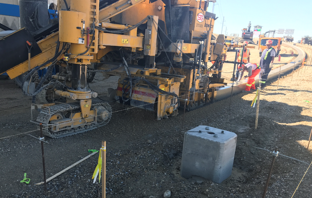
SWCRR equipment

Looking north at 90 Avenue / Elbow River Valley

Looking south at Southland Drive / SWCRR

Looking east at north asphalt plant

Looking north at 37 Street / Glenmore Trail

Looking northeast at bridge construction near Sarcee Trail

Looking northeast at Highway 8 / Sarcee Trail

Looking east at 69 Street / Discovery Ridge Boulevard

Looking east at Highway 8

Looking east at Highway 8
September 2017

Site 1 – Macleod Trail S.E.

Site 1 – Macleod Trail S.E.

Site 1 – Macleod Trail S.E.

Site 2 - 6 Street / Sheriff King Street S.W.

Site 2 – 6 Street / Sheriff King Street S.W.

Site 3 - James McKevitt Road / Spruce Meadows Way S.W.

Site 3 – James McKevitt Road / Spruce Meadows Way S.W.

Site 3 – James McKevitt Road / Spruce Meadows Way S.W.

Site 4 – 188 Avenue S.W. / South Excavation

Site 5 – Highway 22X

Site 4 – South Excavation / 188 Avenue S.W.

Site 6 – South Excavation / 162 Avenue S.W.

Site 7 – 146 Avenue / Fish Creek Boulevard S.W.

Site 7 – 146 Avenue / Fish Creek Boulevard S.W.

Site 8 – Fish Creek

Site 8 - 130 Avenue S.W.

Site 9 – Tsuut’ina Nation Administration Building / Anderson Road S.W. / KGL Office

Site 10 – 90 Avenue / Southland Drive S.W.

Site 10 – 90 Avenue / Southland Drive S.W.

Site 10 – 90 Avenue / Southland Drive S.W.

Site 10 – 90 Avenue / Southland Drive S.W.

Site 11 – Elbow River

Site 11 – Elbow River

Site 11 – Sarcee Trail S.W.

Site 12 – 37 Street S.W.

Site 11 – Sarcee Trail S.W. / Elbow River

Site 11 – Sarcee Trail S.W.

Site 11 – Sarcee Trail S.W.

Site 11 – Sarcee Trail S.W.

Site 13 - 69 Street / Discovery Ridge Boulevard S.W.

Site 13 – 69 Street / Discovery Ridge Boulevard S.W.

Site 14 – Highway 8 / Haul Road

Site 14 – Highway 8 / Haul Road

Site 14 – Highway 8 / Haul Road

Site 14 – Highway 8 / Lott Creek Boulevard / Clearwater Drive S.W.

North Gravel Site

North Gravel Site